
![]()
![]()
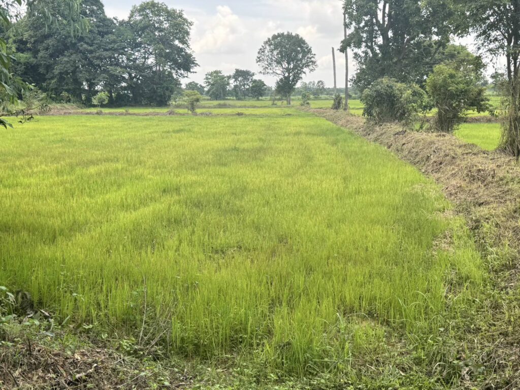
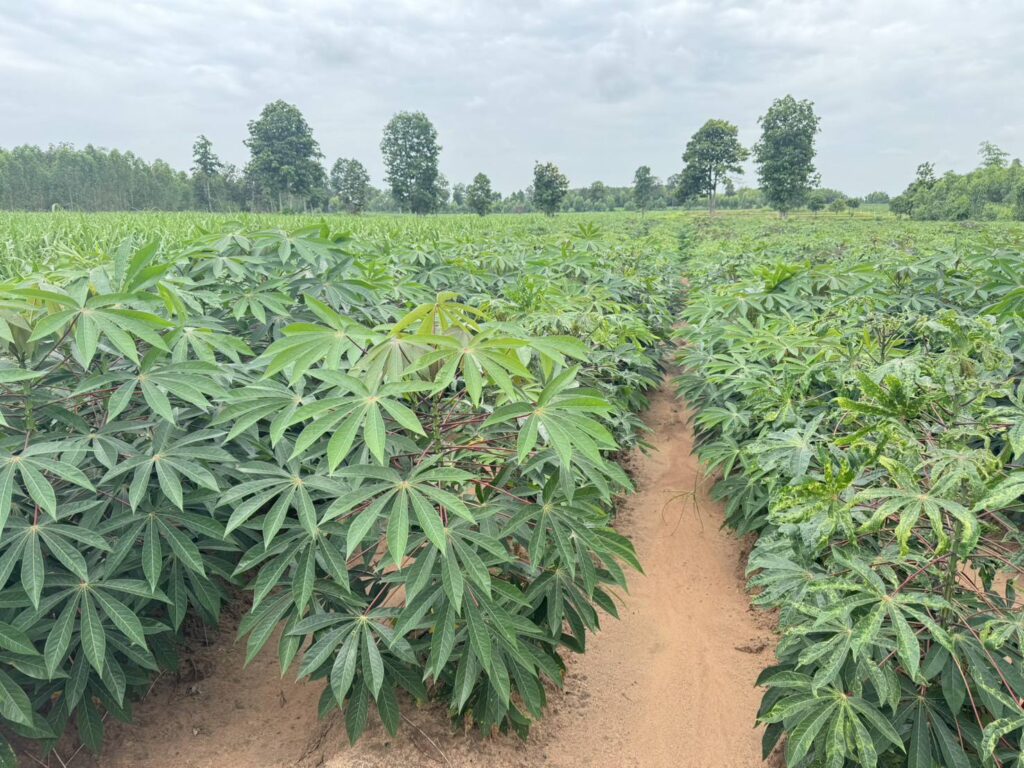
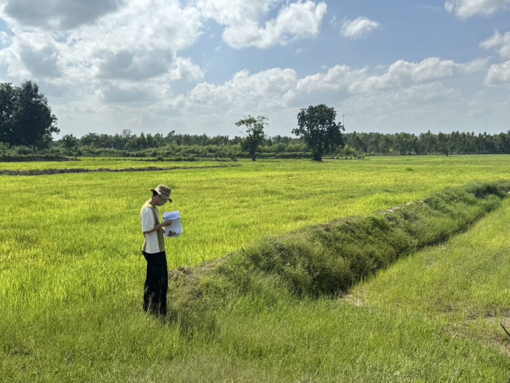
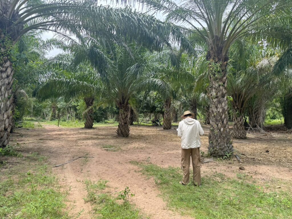
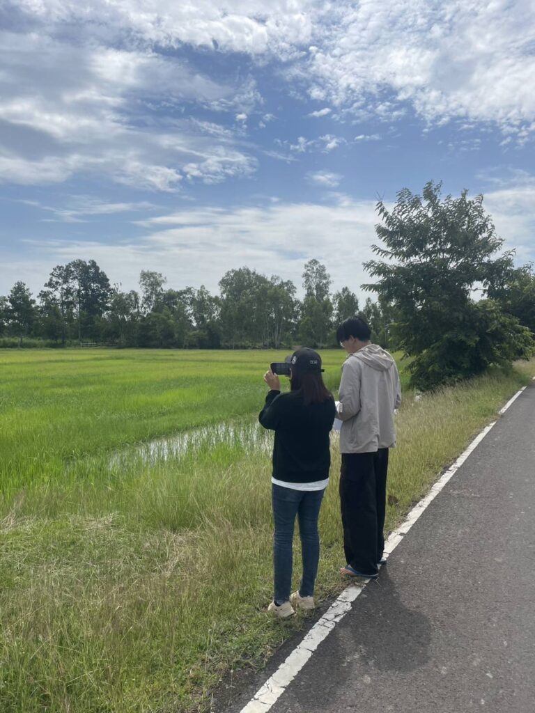
![]() ดร. กฤช เอี่ยมฐานนท์ ผู้อำนวยการศูนย์สารสนเทศการเกษตร มอบหมายให้ส่วนภูมิสารสนเทศการเกษตร ลงพื้นที่เพื่อออกสำรวจพื้นที่เพาะปลูกพืชเศรษฐกิจ 5 ชนิด ได้แก่ ข้าว มันสำปะหลังโรงงาน สับปะรด ปาล์มน้ำมัน และยางพารา
ดร. กฤช เอี่ยมฐานนท์ ผู้อำนวยการศูนย์สารสนเทศการเกษตร มอบหมายให้ส่วนภูมิสารสนเทศการเกษตร ลงพื้นที่เพื่อออกสำรวจพื้นที่เพาะปลูกพืชเศรษฐกิจ 5 ชนิด ได้แก่ ข้าว มันสำปะหลังโรงงาน สับปะรด ปาล์มน้ำมัน และยางพารา ![]()
![]() ระหว่างวันที่ 6 – 14 กรกฎาคม 2568 จำนวน 200 จุดตัวอย่าง เพื่อตรวจสอบความถูกต้องของผลการแปลวิเคราะห์ภาพถ่ายจากดาวเทียมรายละเอียดปานกลาง (Medium resolution satellite image) ประกอบด้วย กลุ่มดาวเทียม Sentinel-2 และ Landsat 8-9 OLI/TIRS ในกิจกรรมการจัดทำแผนที่พืชเศรษฐกิจเชิงเดี่ยว (Single map) ภายใต้โครงการเพิ่มประสิทธิภาพการจัดทำสารสนเทศการเกษตรและการบริหารจัดการข้อมูลขนาดใหญ่ ปีงบประมาณ พ.ศ. 2568 ดำเนินงานในพื้นที่ 4 จังหวัด ได้แก่ จังหวัดชัยภูมิ นครราชสีมา บุรีรัมย์ และสุรินทร์ การดำเนินโครงการนี้มีวัตถุประสงค์หลักเพื่อจัดทำข้อมูลแผนที่เนื้อที่เพาะปลูก/ยืนต้นพืชเศรษฐกิจข้างต้นที่ส่วนภูมิสารสนเทศการเกษตรดำเนินการจัดทำเป็นรายปีและรายฤดูกาลเพาะปลูก ให้มีความเป็นเอกภาพ สอดคล้อง และไม่มีการแสดงการใช้ประโยชน์ที่ดินทางการเกษตรที่ทับซ้อนกัน ซึ่งจะช่วยเพิ่มความถูกต้องและความน่าเชื่อถือต่อกระบวนการจัดทำข้อมูลสถิติการเกษตรของประเทศไทย อันเป็นหนึ่งในภารกิจหลักของศูนย์สารสนเทศการเกษตร
ระหว่างวันที่ 6 – 14 กรกฎาคม 2568 จำนวน 200 จุดตัวอย่าง เพื่อตรวจสอบความถูกต้องของผลการแปลวิเคราะห์ภาพถ่ายจากดาวเทียมรายละเอียดปานกลาง (Medium resolution satellite image) ประกอบด้วย กลุ่มดาวเทียม Sentinel-2 และ Landsat 8-9 OLI/TIRS ในกิจกรรมการจัดทำแผนที่พืชเศรษฐกิจเชิงเดี่ยว (Single map) ภายใต้โครงการเพิ่มประสิทธิภาพการจัดทำสารสนเทศการเกษตรและการบริหารจัดการข้อมูลขนาดใหญ่ ปีงบประมาณ พ.ศ. 2568 ดำเนินงานในพื้นที่ 4 จังหวัด ได้แก่ จังหวัดชัยภูมิ นครราชสีมา บุรีรัมย์ และสุรินทร์ การดำเนินโครงการนี้มีวัตถุประสงค์หลักเพื่อจัดทำข้อมูลแผนที่เนื้อที่เพาะปลูก/ยืนต้นพืชเศรษฐกิจข้างต้นที่ส่วนภูมิสารสนเทศการเกษตรดำเนินการจัดทำเป็นรายปีและรายฤดูกาลเพาะปลูก ให้มีความเป็นเอกภาพ สอดคล้อง และไม่มีการแสดงการใช้ประโยชน์ที่ดินทางการเกษตรที่ทับซ้อนกัน ซึ่งจะช่วยเพิ่มความถูกต้องและความน่าเชื่อถือต่อกระบวนการจัดทำข้อมูลสถิติการเกษตรของประเทศไทย อันเป็นหนึ่งในภารกิจหลักของศูนย์สารสนเทศการเกษตร![]()
![]()
![]()
![]()
![]()
![]() Dr. Krit Iemthanon (Ph.D.), Director of the Centre for Agricultural Information (CAI), Office of Agricultural Economics (OAE) has assigned the Division of Agricultural Geo-Informatics to conduct the field survey of five major economic crops—rice, cassava (for industrial use), pineapple, oil palm, and para rubber—between
Dr. Krit Iemthanon (Ph.D.), Director of the Centre for Agricultural Information (CAI), Office of Agricultural Economics (OAE) has assigned the Division of Agricultural Geo-Informatics to conduct the field survey of five major economic crops—rice, cassava (for industrial use), pineapple, oil palm, and para rubber—between![]()
![]() July 6-14, 2025. These 200 sampling points consist of locations across four provinces in the Northeast region—Chaiyaphum, Nakhon Ratchasima, Buriram, and Surin—and will be examined to verify the accuracy of crop classification results derived from medium-resolution satellite imagery.
July 6-14, 2025. These 200 sampling points consist of locations across four provinces in the Northeast region—Chaiyaphum, Nakhon Ratchasima, Buriram, and Surin—and will be examined to verify the accuracy of crop classification results derived from medium-resolution satellite imagery.
The satellite data used in this effort includes imagery from the Sentinel-2 and Landsat 8–9 OLI/TIRS satellite constellations, as part of the “Single Map” activity under the “Improving the efficiency of agricultural information management and big data management” project for economic single mapping. The main objective of the project is to develop unified and consistent maps showing the cultivated and perennial areas of key economic crops. These maps are generated annually and seasonally by the Agricultural Geo-Informatics Division. The project aims to eliminate overlapping land use data, enhance the accuracy and reliability of agricultural statistical processes, and support the broader mission of the Centre for Agricultural Information (CAI) in delivering precise and trustworthy agricultural data for Thailand. ![]()
![]()
![]()